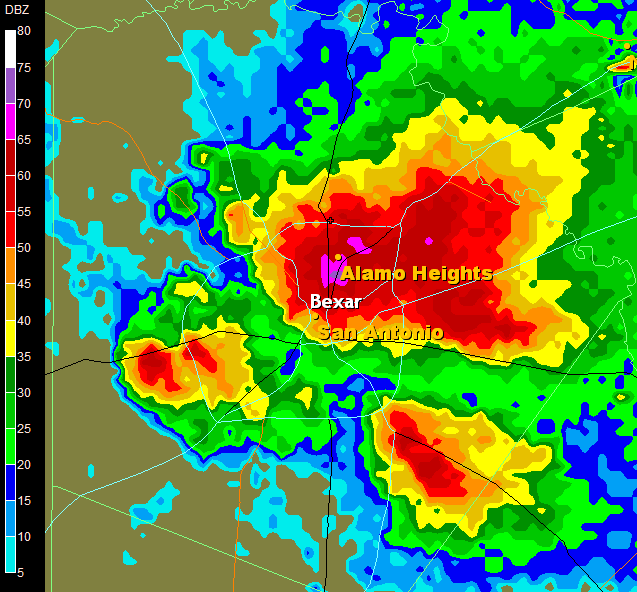
This Doppler Radar image is of San Antonio during a large hail storm, The areas of red and purple show the areas of highest return, meaning they are where the most rain and and hail are located. Doppler is used by weather services to determine the amount, speed, and direction of rain.
http://media.photobucket.com/image/doppler%20radar/alamocitywx/radar5_2_05-1.png

No comments:
Post a Comment