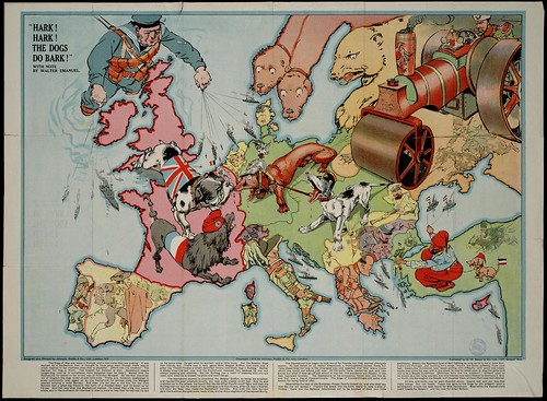
 Propaganda maps are used by the government to persuade people of certain plans or educate the public, they can also be used as method of intimidation against other countries. This map is of Europe during World War 1, it uses people as well as animals to show the different sizes of countries and their power.
http://farm4.static.flickr.com/3281/2722416468_1aebcdebb2.jpg

No comments:
Post a Comment