Wednesday, April 14, 2010

#22: Isopachs


Isopach lines connect areas of the same thickness on a map. This map shows the elevation as well as the thickness of a reservoir, the isopachs are shown by the red dashed lines.

http://www.glossary.oilfield.slb.com/files/OGL98135.gif

#21: Isohyets


Isohyets are lines of equal precipitation on a map. This map is of India showing areas and amounts of rainfall.

http://www.unu.edu/unupress/unupbooks/80391e/80391E00.GIF

#20: Isotachs


Isotachs are similar to isobars, however they are continuous lines that attach areas of the same wind speed. This image shows isotachs as well as heights. The solid lines acts a s a topograph in that they connect areas of same height, the dashed lines are the isotachs showing the similar wind speeds.

http://eumetcal.meteo.fr/euromet/resource/nwp/n8400/n8400004.gif

#19: Isobars

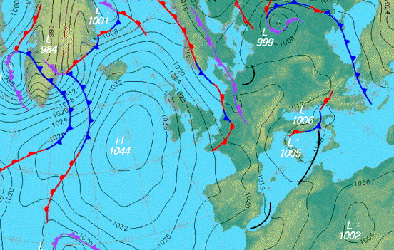
Isobars are lines showing areas of constant pressure, areas of the same pressure are connected by continuous lines. This map shows pressures over Europe and the Atlantic ocean.
http://www.halesowenweather.co.uk/isobars.gif

#18: Doppler Radar


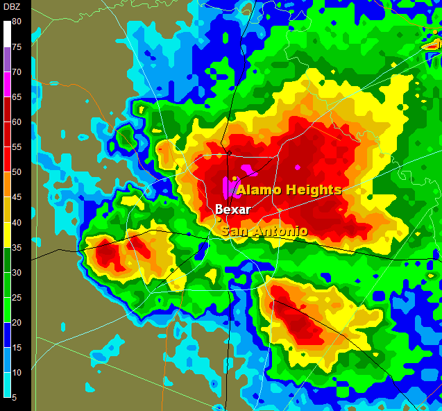
This Doppler Radar image is of San Antonio during a large hail storm, The areas of red and purple show the areas of highest return, meaning they are where the most rain and and hail are located. Doppler is used by weather services to determine the amount, speed, and direction of rain.

http://media.photobucket.com/image/doppler%20radar/alamocitywx/radar5_2_05-1.png

#17: Black and White Aerial Photo


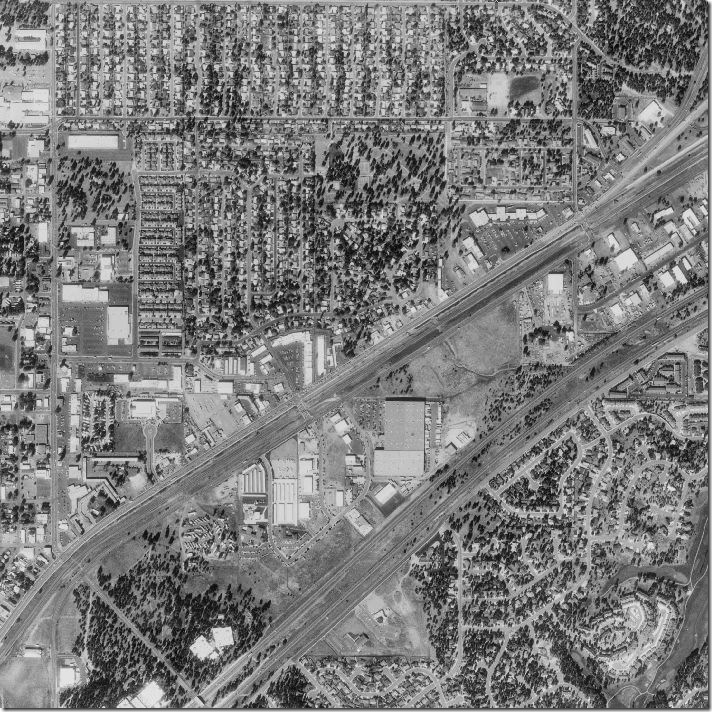
Black and white aerial photographs are used to survey land, they are different from infrared in that they do not show the health of land areas, they focus more on boundaries.
http://freegeographytools.com/wp-content/uploads/2007/09/doq-thumb.jpg

Tuesday, April 13, 2010

#16: Infrared Aerial Photo

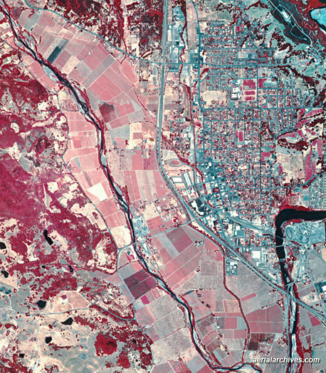
Infrared aerial photos can be used to show changes in the environment, such as the health of forests and oceans. It is also used on farms to detect changes in land and possible diseases or infestations. This map shows land in Sonoma County, Ca.

http://www.aerialarchives.com/stock/img/AHLV2002.jpg