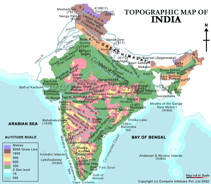
 This topographic map of India displays the many regions as well as their altitudes. In addition to just showing land masses it also shows the surrounding bodies of water and their depths as well. The graph uses a colored key system to describe the different ares altitudes, each color is paired with a specific number of meters and anywhere that color exists so does the corresponding altitude. The map seems to focus mainly on general regions, it is not to scale therefore it does follow the correct latitude and longitude system.
information from:
http://www.mapsofindia.com/maps/india/topographic-map.htm

No comments:
Post a Comment